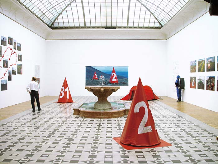

spor walking a big picture
scroll down for english version
Island, 2005
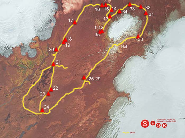
Im isländischen Hochland habe ich unter Berücksichtigung geografischer Vorgaben nach dem Zahlenverbindungs-Prinzip („dot to dot“) ein etwa
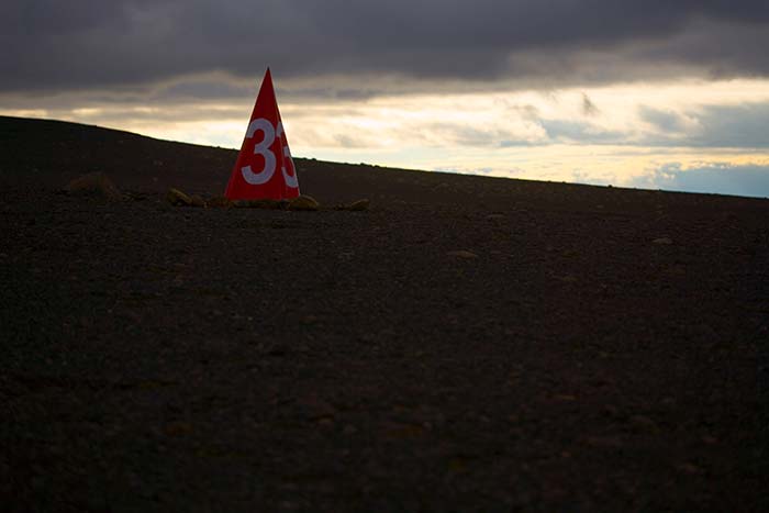
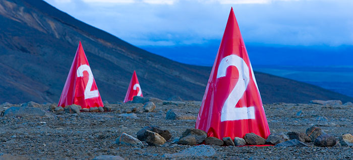
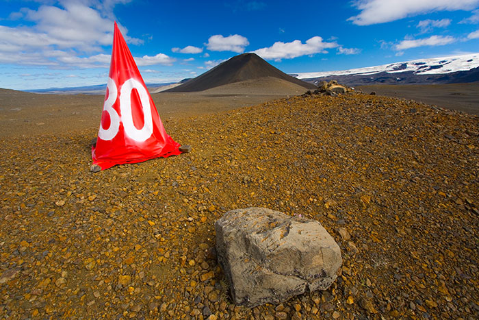
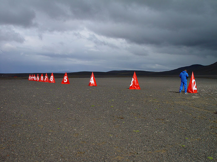
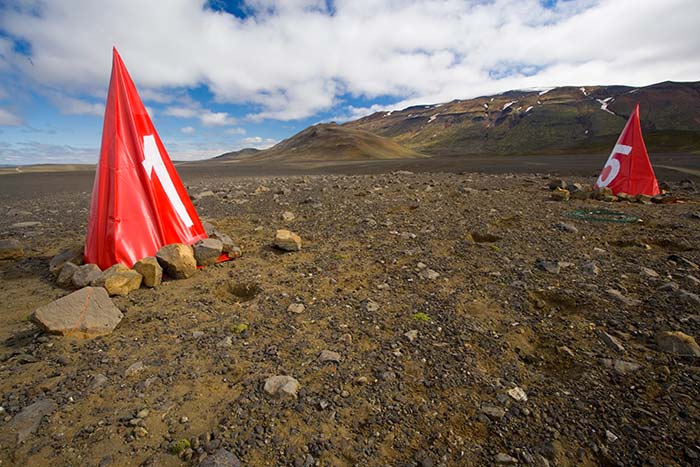
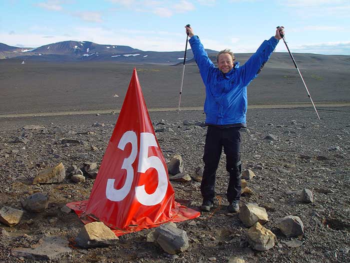
3000 km2 großes Bild in die Landschaft gewandert. Zuvor per Geländewagen errichtete Kegelobjekte dienten als Landschaftszeichen zur groben Orientierung und Markierung des Aktionsgebietes.
Jeder meiner Schritte der 245 km langen Strecke wurde per GPS Signal aufgezeichnet und die gewanderte Linie auf eine virtuelle Satellitenkarte im Internet unter www.spor-online.de via Satphone übertragen. Natürliche Hindernisse gaben der „Zeichnung“ immer wieder neue Konturen, so dass
durch die Natur die (geplante) Pflicht immer wieder zur Kür wurde.
Der Künstler als Werkzeug, als lebendiger Zeichenstift sozusagen wird selbst Teil eines gigantischen Spiels mit den Dimensionen. Die gewanderte Spur stellt bezeichnenderweise meinen eigenen (linken) Fußabdruck dar, der durch objektive Vorgaben (Wasserläufe, Canyons, Lavaberge) immer wieder Änderungen erfuhr und somit meiner Façon des Zeichnens entspricht.
Erstaunlicherweise findet sich eine spiegelverkehrte, landschaftliche Entsprechung meines Fußabdrucks in Form eines Gletschers wieder,
getrennt durch die in Island allgegenwärtige Plattentektonik. Ich verstehe das Projekt „Spor“ auf zwei Ebenen: zum einen als Versuch landschaftlicher Markierung, zum anderen als Grenzgang zeichnerischer Dimensionierung, vorzugsweise in einem extremen Land, das durch seine geografische wie gesellschaftliche Strukturierung immer schon zwischen den Welten lag und gerne als „Schritt“ über den Atlantik wahrgenommen wird.
Begleitet wurde ich in der Aufbauphase vom Fotografen Eugen Gebhardt, bei
der Erwanderung von meinem Cousin Andy Reimann.
Iceland, 2005
In the Highlands of Iceland I have walked a 3000 km2 “dot to dot”- picture into the landscape in consideration of geographical facts. The red cones, being installed by using a Lada Jeep served for rough navigation and as land marks of the project’s environment.
Each step of the 250 km walk was tracked by the GPS and the covered distance was visualized and transmitted to an internet satellite map under www.spor-online.de via Iridium sat phone. Natural barriers gave consistently new outlines to the “drawing”, so that nature made “freestyle” out of the planned “duty”. The artist as an instrument, a living pencil, became part of a gigantic play with dimensions.
The walked track significantly described my own (left) footprint and this line had to experience a lot of changes depending on conditions of landscape (waterfalls, canyons, lava fields), which is indeed corresponding to my way of drawing on paper.
Amazingly there exists a mirror-inverted, natural equivalent to my footprint in the form of “Langjökull” glacier , separated by the continental drift, which is omnipresent all over Iceland.
Project “Spor” works on two levels: first it is kind of a landscape marking, second it is the edge of artwork dimensioning, particularly within an extreme country, which has always been located between the worlds because of its geographical and social structure, like a “step” across the Atlantic Ocean. I was accompanied by photographer Eugen Gebhardt during the installation and by my cousin Andi Reimann during the hike.